Aptent tincidunt lobortis eveniet! Molestie accusamus qui magna, consequatur posuere, sociosqu phasellus, nam sit dis fuga nemo eu, per duis vestibulum eveniet exercitationem assumenda, totam.
Post Categories
No categories
Recent Blog
No Posts Found.
Multidimensional spatial analysis
in the GIS environment
Investments options analysis
Analyses of demographic and socio-economic conditions
Graphic documentation
Spatial analysis
Spatial analyses performed at an early stage of infrastructure projects are their key element. Performed in a GIS environment, they provide fundamental and comprehensive information on the investment’s impact on the urban space, natural environment and socio-economic processes. Spatial analyses are helpful at every scale – both local, regional and much larger. They improve decision-making processes, allow to early identify potential problems and, as a result of mentioned, ensure the fluidity and efficiency of work on the project.
Multidimensional GIS analyses for planning documents and transport plans
We offer multidimensional spatial analyses using GIS tools such as ArcMAP and QGIS, supporting the development of various planning documents. Our team performs analyses for transport plans at various levels of administrative units – local, regional and national. Thanks to advanced tools, we provide precise research that takes into account a wide range of input data – spatial, social, economic and legal, which make up a comprehensive planning picture
Analyses of demographic and socio-economic conditions
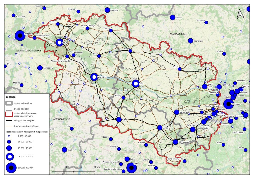
We perform extensive analyses of demographic conditions, considering migration processes, changes in social structures and natural populace increase. We examine the spatial distribution of mineral resources, enterprises, human capital and many others, what provides a solid basis for making decisions in your project.
Accessibility analysis
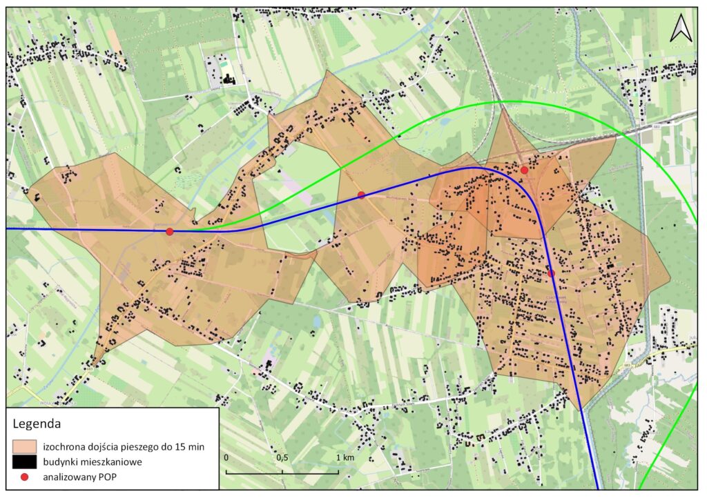
We perform accessibility analysis of existing or planned passenger infrastructure as part of the Feasibility Study, Transport Plan and other planning documents. We examine population potentials within walking distance or car journey of a specified time to the selected stop, and we calculate the number of potential users based on demographic data. Our analyses provides comprehensive support in planning an effective transport network, both long-distance and local.
Investment analysis
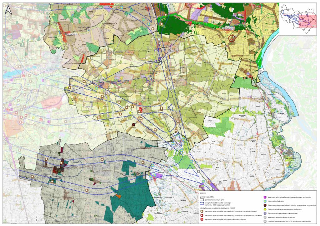
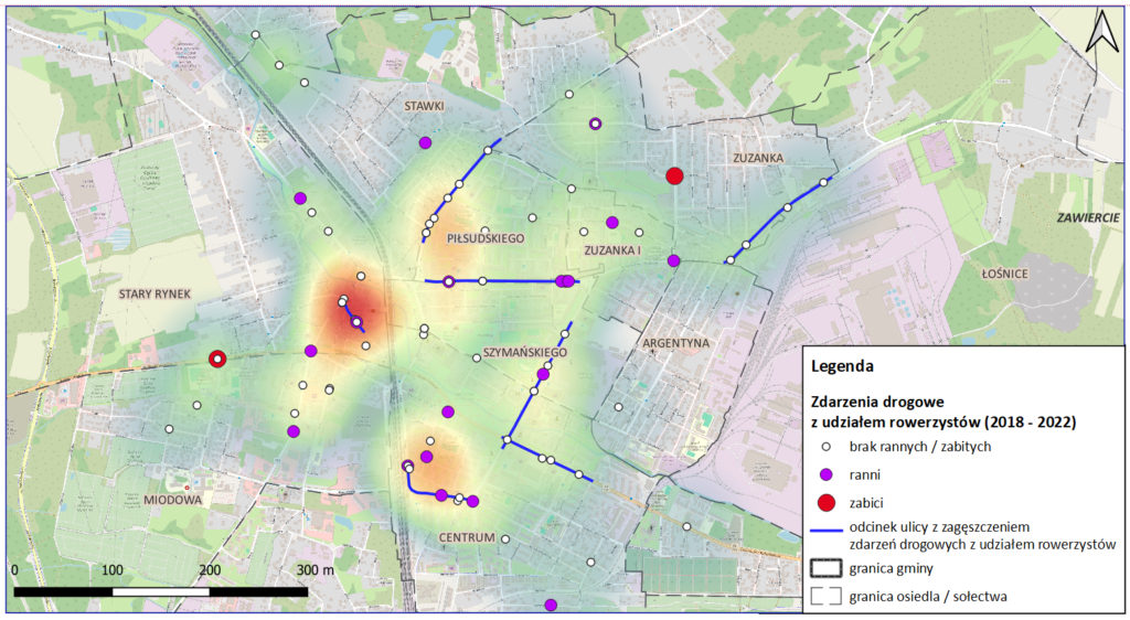
We specialize in performing analyses of the impact of infrastructure investments on urban space, natural environment and socio-economic processes. We point out potential conflicts with existing and planned infrastructure, preventing potential future problems. We support selecting the optimal variant of project implementation, such as the course of a new road, railway line, bicycle path or pedestrian route.
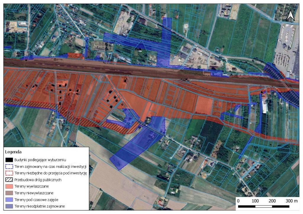
In addition, with the support of GIS tools, we perform real estate buyout estimation analyses (for linear investments covering large areas too) minimizing the risk of legal conflicts and optimizing investment costs.
Graphic presentation
We create advanced graphics in line with modern cartographic and design standards, presenting various space conditions.